

Neumann-4 OBIA (Object-Based Image Analysis) method maps Chambal terrain with 91.5% accuracy, aiding land restoration efforts effectively.
Authors
Rohit Kumar, Jindal School of Environment & Sustainability, O.P. Jindal Global University, Sonipat, India
Rahul Devrani, Assistant Professor, Jindal School of Environment & Sustainability, O.P. Jindal Global University, Sonipat, India
Manish Pandey, Marwadi University Research Center (MURC), Marwadi University, Rajkot, India; Department of Civil Engineering, Faculty of Engineering & Technology, Marwadi University, Rajkot, India
Benidhar Deshmukh, Discipline of Geology, School of Sciences, Indira Gandhi National Open University, New Delhi, India;
Romulus Costache, Department of Civil Engineering, Transilvania University of Brasov, Brasov, Romania; Danube Delta National Institute for Research and Development, Tulcea, Romania; National Institute of Hydrology and Water Management, Bucharest, Romania; Research Institute of the University of Bucharest, Bucharest, Romania
Summary
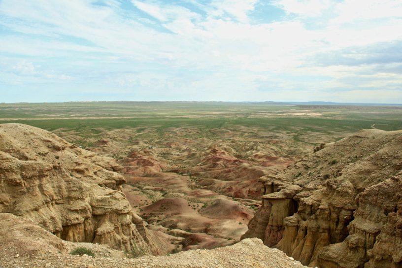
This study maps the rugged topography of Chambal region, India’s largest and complex in the southern Marginal Ganga Plain, marked by a peripheral bulge. Mapping these gully systems is challenging due to their varied characteristics, including size, shape, distribution, and LULC changes caused by human activities. Leveraging the freely available data and software, a semi-automatic Object-Based Image Analysis (OBIA) approach on 10m resolution Sentinel-2 imagery was employed to address the challenges posed by the diverse characteristics of these formations. Two Object-Based Image Analysis (OBIA) methods Moore-8 and Neumann-4 neighborhood grouping embedded in SAGA GIS were tested for feature extraction in one sub-watershed.
The Neumann-4 method outperformed Moore-8, achieving an accuracy rate of 89.58%, compared to 75.69% for Moore-8. Consequently, Neumann-4 was applied across all sub-watersheds of the lower Chambal basin, identifying 1,665.53 km² of rugged topography with an overall accuracy of 91.5%. Additionally, ALOS PALSAR and SRTM DEMs were used to classify the terrain based on depth, with SRTM DEM proving more effective. The study recommends targeted interventions like bund construction, contour farming, and check dams to mitigate the environmental impact of gully erosion. These findings offer a robust framework for land restoration and sustainable management in the degraded landscapes.
Published in: International Journal of River Basin Management
To read the full article, please click here.